- The paper demonstrates that twin-tower CNN architectures, especially the TTS variant, achieve a high AUC of 0.8302 for detecting building damage.
- It employs a novel data generation pipeline using manual UNOSAT assessments and ML filtering to process high-resolution pre- and post-disaster images.
- The study underscores the importance of diverse training data for cross-region generalization, enhancing model performance across various disaster events.
Building Damage Detection in Satellite Imagery Using CNNs
This paper focuses on automating the detection of building damage in satellite imagery using convolutional neural networks (CNNs). The research explores various CNN architectures to assess their efficacy in identifying damaged buildings, particularly following disasters like earthquakes.
Data Generation Pipeline
The study begins by constructing a novel data set comprising satellite imagery from three significant disaster events: Haiti, Mexico City, and Indonesia earthquakes. The data generation process includes obtaining high-resolution pre- and post-disaster images primarily sourced from DigitalGlobe's satellites. Building detection involves leveraging manual damage assessments, where damaged buildings are identified and labeled using a Faster-RCNN model trained on extensive datasets (Figure 1).
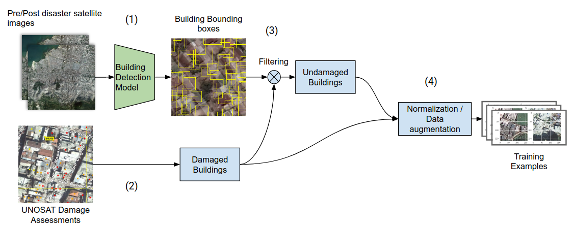
Figure 1: The data generation pipeline: pre- and post-disaster images are processed to identify damaged buildings through UNOSAT assessments.
Notably, the generation of undamaged building examples employs an ML model to detect structures, filtering out those tagged as damaged. These examples undergo standard normalization and data augmentation techniques to enhance model training.
Model Architecture Comparisons
The research evaluates four distinct CNN architectures: Concatenated Channel (CC), Post-image Only (PO), Twin-tower Concatenate (TTC), and Twin-tower Subtract (TTS). Each architecture processes satellite imagery differently to detect building damage.
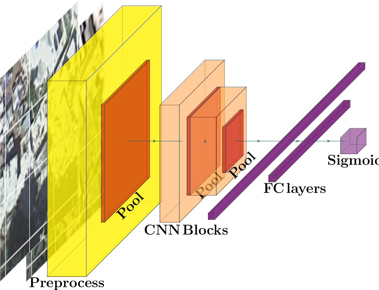
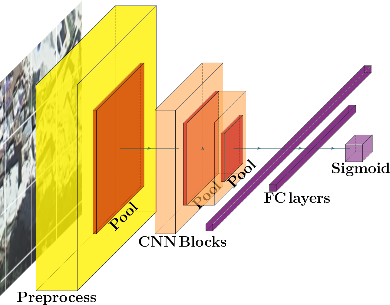
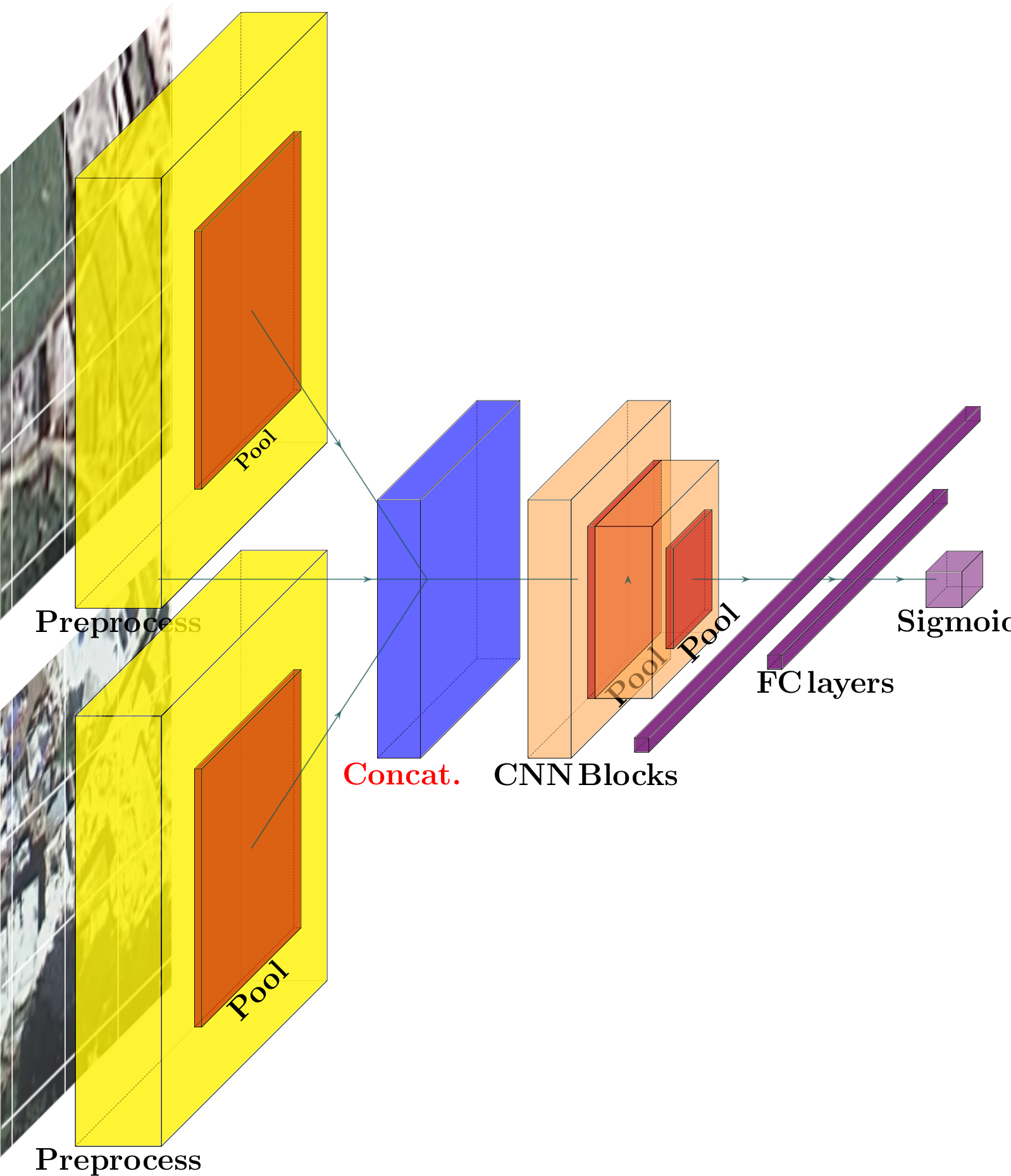
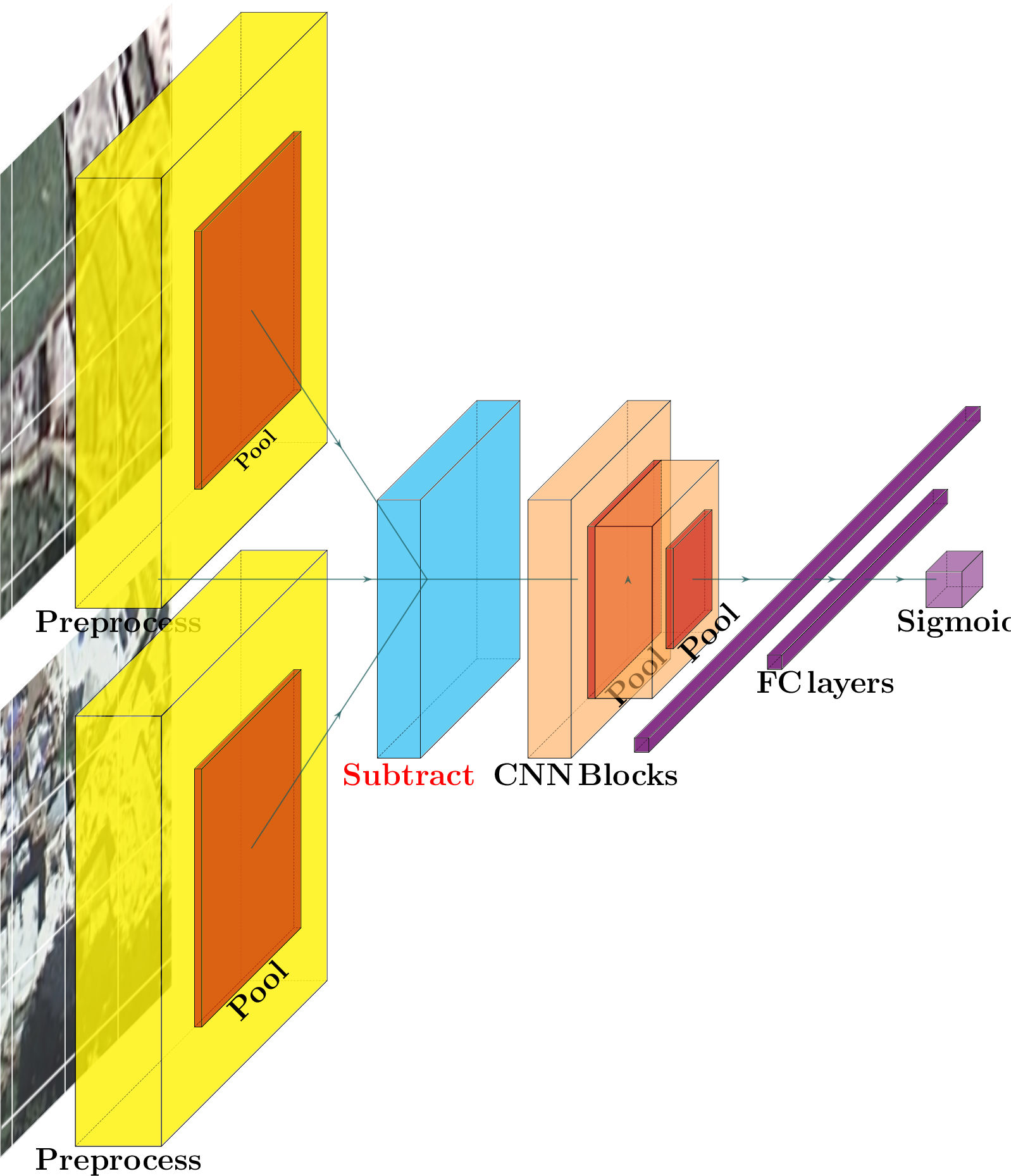
Figure 2: Model architecture variants demonstrate different approaches to processing satellite imagery input.
The Twin-tower Subtract (TTS) model emerges as the most effective, achieving the highest AUC of 0.8302. This indicates superior capability in capturing differences between pre- and post-disaster images, which are indicative of damage. The twin-tower models generally outperform single tower models, emphasizing the importance of comparing pre- and post-disaster imagery at a feature level.
Cross-Region Generalization
A critical component of the research is assessing model generalization across different disasters and regions. Experiments reveal that models trained exclusively on one dataset perform poorly when tested on another due to insufficient diversity in training data. However, training models on multiple datasets enhances generalization. Furthermore, introducing manual data annotations from novel disaster conditions significantly boosts model accuracy.
The results underline the necessity for diverse training data to mitigate overfitting risks and improve cross-region performance. They also suggest strategic deployment involving modest manual annotations in new disaster zones to optimize model accuracy.
Conclusion
The paper successfully demonstrates the potential of CNNs in automating building damage detection from satellite imagery. It highlights the effectiveness of twin-tower architectures, particularly the TTS variant, and emphasizes the importance of data diversity for model generalizability. Future work aims to extend model applicability to new disaster types and refine robustness against common satellite image imperfections.
Overall, this research provides valuable insights into using automated methodologies for rapid and accurate damage assessment in disaster response scenarios, potentially transforming operational capabilities in humanitarian aid logistics.
The advancement of this research challenges existing paradigms in damage assessment, showcasing CNNs as viable tools for enhancing accuracy and efficiency in disaster response operations. Future endeavors may focus on augmenting training data repositories and refining algorithmic robustness to support real-time, scalable deployment in various disaster scenarios.